
It’s time to get up and move!
Active transportation is transportation powered by human energy, primarily walking and bicycling and even rolling using wheelchairs, scooters, or skateboards. Using public transportation is another form of active transportation, as people tend to move themselves to get to and from bus stops.
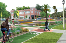
Active transportation is a vital component of creating livable and sustainable communities. Communities designed with safe walking and biking infrastructure promote health by providing opportunities for people to incorporate physical activity into their daily routines. Active communities help reduce traffic congestion, climate-polluting vehicle emissions, dependence on fossil fuels, and land consigned to car storage.
Programs
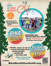
Every May, HCAOG teams up with the Bike Month Humboldt Coalition to bring the National Bike Month celebration to Humboldt! HCAOG also sponsors the Humboldt Bike Challenge! All events are free and open to everyone in the County. Find a full list of that last Bike Month's events and details on BikeMonthHumboldt.org. See the past (2026) calendar of events here.
- Join the Bike Challenge! Create a free account at lovetoride.net/humboldt to join the challenge. Whether you want to get in better shape, save money and improve the environment by driving less, or simply have fun riding a bicycle- the bike challenge is a great way to track your rides and get motivated by others in the Humboldt biking community.
- The Bike-Friendly Business program is back! This popular initiative is a win-win-win. Get some fresh air and ride your bike to a participating local business, boost the local economy, AND get a free perk or discount! Look for the orange window sign and just show your bike, helmet, or a Bike Month Humboldt sticker to get the discount.
The Bike Month Coalition is comprised of members representing Humboldt Bay Bicycle Commuters Association, North Coast Co-op, Coalition for Responsible Transportation Priorities, DHHS Healthy Communities, Humboldt Bicyclists, Redwood Coast Mountain Bike Association, Caltrans District 1 Active Transportation, HCAOG, and other bike enthusiasts.
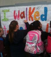
Safe Routes to School (SR2S) is a nationwide movement to make it safer for children to walk and bicycle to school. SR2S promotes walking and bicycling to school through targeted education, encouragement, enforcement, and engineering projects. SR2S programs are alive and active in Humboldt County.

In September 2021, HCAOG launched the online interactive bike map! The result is the most accurate bicycle map for Humboldt County as we had a dozen volunteers verify the data on the ground.
How to use the online bike map:
1. Navigate to https://hcaog.net/map from your mobile phone, tablet, or desktop internet browser.
2. In the upper right, click the compass symbol to navigate to your location.
3. Use the toggles on the side-bar to explore different bike routes and points of interest.
- Existing bike routes are shown in solid colors
- Connector routes are roads often used by cyclists, and are designated in dashed lines by their relative comfort level
- Icons show bicycle shops, bike rental locations, and tool stations
At this time, the tool does not work like Google Maps where you can get directions between two locations. There is no best way to get places by bicycle, as every person will have a different level of comfort. Using our map as a reference can help plan a route. Also note that Google Maps has some inaccurate bicycle route information.
2018 Humboldt Bay Area Bike Map (PDF)
Hundreds of these free bike maps were provided at local bike shops, book stores, hotels, and visitor centers. Printed copies are out of stock , but you can still view the map and print it, below.
Highlights
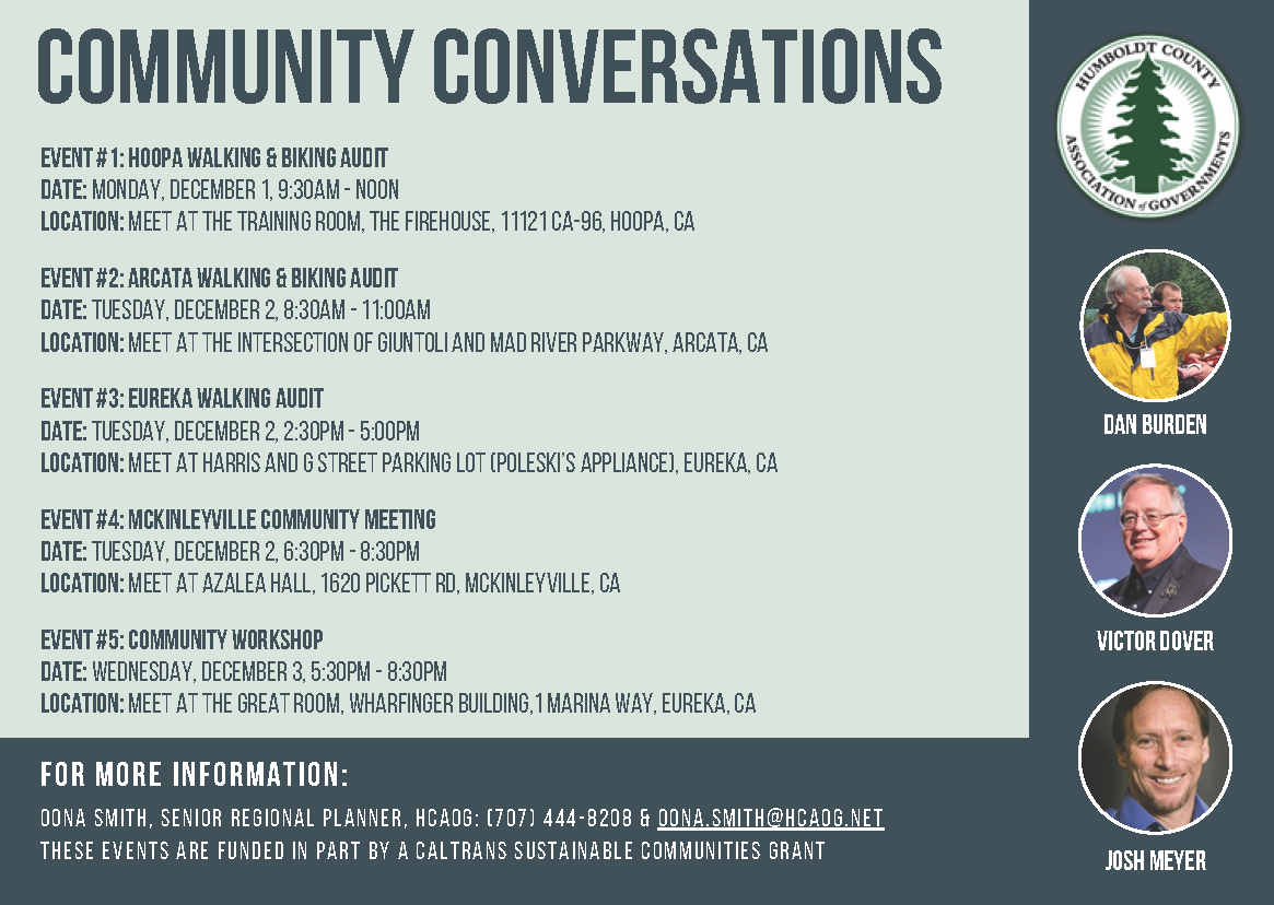
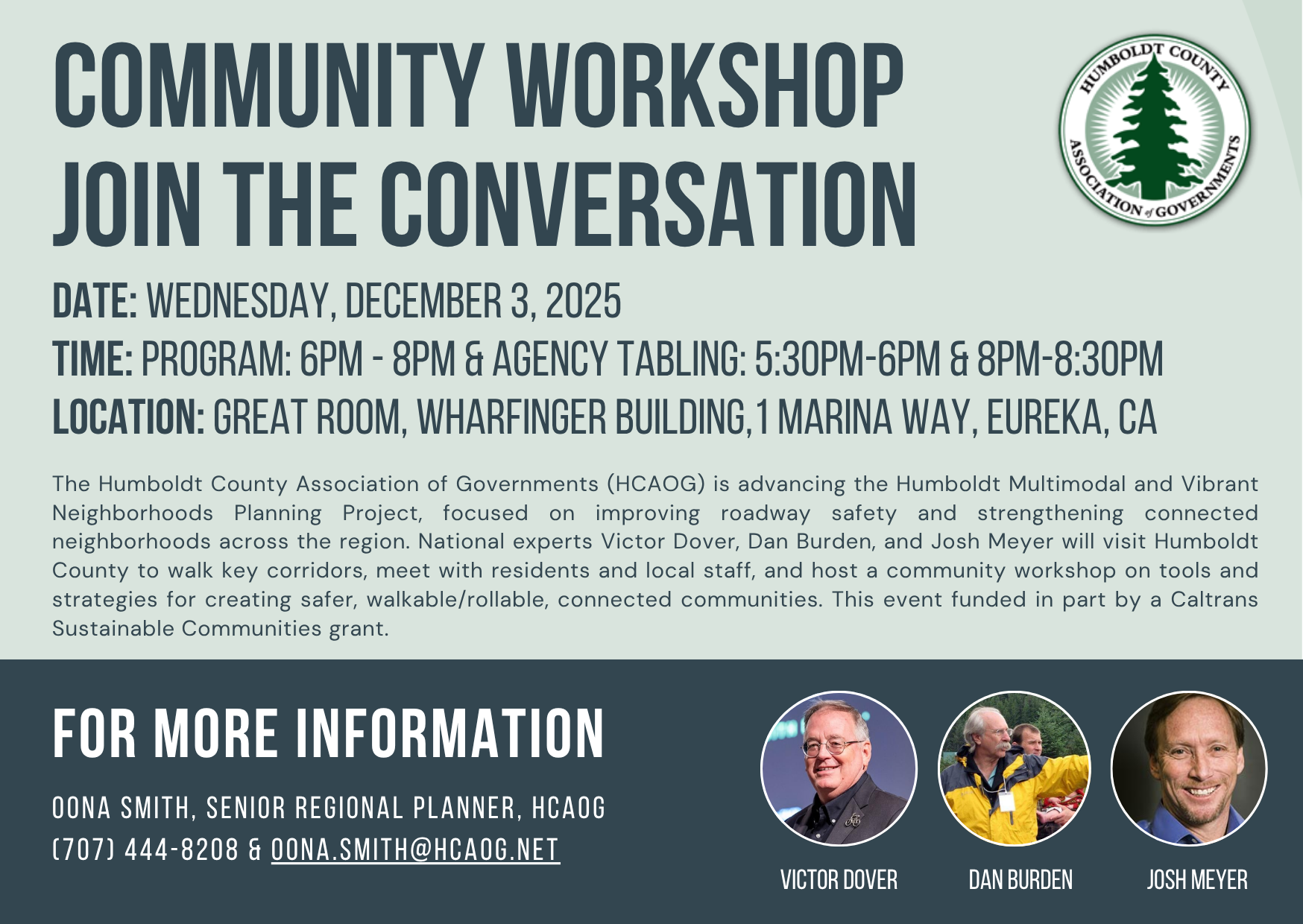
HCAOG's Humboldt Multimodal and Vibrant Neighborhoods Planning Project* focuses on improving roadway safety and strengthening connected neighborhoods across the region. National experts Victor Dover, Dan Burden, and Josh Meyer visited Humboldt County to walk key corridors, meet with residents and local staff, and host a community workshop on tools and strategies for creating safer, walkable, connected communities. (Read event details in the press release.)
Click COMMUNITY WORKSHOP video recording to watch (or listen to) the entire presentation. (Held Dec. 3, 2025, at the Wharfinger Building, Eureka, CA.)
To request Dan & Victor's slidedeck, contact HCAOG.
*Funded in part by a Caltrans Sustainable Communities grant.
Haga clic aqui para informe en español 
SEE MORE below under the pull-down:
"Walkability Audits & Presentations (2023 & 2025 Dan Burden visits)"

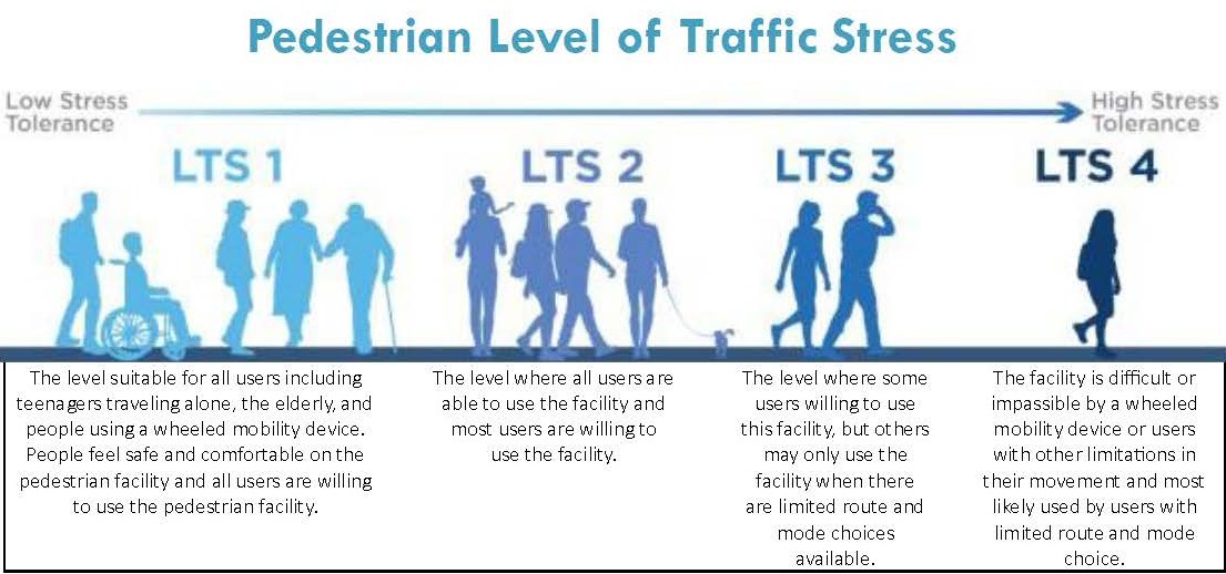
The "level of traffic stress" (LTS) is a metric for assessing the level of comfort or stress that people would feel when they are bicycling and/or walking and rolling on streets/roads.
Different people have different tolerances for the kinds of places they will walk, bike, or roll. Generally, research shows that a relatively small number of people have a confident or fearless attitude and will bike or walk almost anywhere, but on busier streets most people require more comfortable infrastructure like good sidewalks and bike lanes. Researchers and planners quantify this idea as the level of traffic stress, or LTS, which is a score ranging from 1 to 4. LTS 1 represents conditions that almost everyone—including most kids—can tolerate. LTS 2 represents conditions that most adults will tolerate, while LTS 3 and 4 represent conditions that only smaller numbers of adults will tolerate.
In 2024-2025, HCAOG partnered with the Coalition for Responsible Transportation Priorities (CRTP) to create LTS methodology for Humboldt, and apply it to the Greater Humboldt Bay/Wigi Area.‡
Before you review the LTS results, it's important to understand the methodology. For example, the pedestrian LTS results show the vast majority of streets and roads in the area are "high stress," meaning they scored LTS 3 or 4. The score depends on conditions at the exact location, but common reasons for a higher stress pedestrian score are that (i) a street's sidewalk is less than 4-feet wide at its narrowest point (which may be next to a utility pole or a tree), or (ii) an intersection doesn't have a curb ramp. Such criteria are meant to reflect the experiences of people using wheelchairs, strollers, and other devices. Where a bike lane exists, a higher stress bicycle score may reflect that the lane is too narrow (due to a drainage grate, for example). Conversely, a combination of a wide shoulder, a buffer, and low traffic volume may result in a lower stress outcome than a street segment with a bike lane.
Considering the experiences of everyone in the local population is key to getting the LTS scores right.
CHECK OUT the ONLINE, INTERACTIVE APPLICATION
Humboldt Multimodal and Vibrant Neighborhoods Planning Project (Public)
‡This subject project area consists of: Eureka (Jaroujiji*), Arcata (Goudi’ni*), Bayside, McKinleyville (Dalhagali'*), Fortuna (Vutsuwitk Da'l*), Manila, Samoa, Fairhaven, Cutten, King Salmon, and Loleta (Guduwalha't*) including the Wiyot Tribe Table Bluff Reservation (Rraloughugu'w*). *Place name in Wiyot language, Soulatluk.
~ HCAOG aims to make a tool that will be valuable for local jurisdictions to refer to, periodically update, and to utilize when evaluating where, what, and when to invest in transportation planning, programs, and projects. HCAOG will expand the LTS assessment for the rest of Humboldt County in the near future, as stated in our Regional Transportation Plan ("VROOM 2022-2042").
The LTS assessment is part of the “Humboldt Multimodal and Vibrant Neighborhoods Planning” project, funded by a Caltrans Sustainable Transportation Planning Grant and local matching funds from Technical Advisory Committee (TAC) member agencies and other partners.
"Pedestrian Level of Traffic Stress" diagram from Florida DOT:
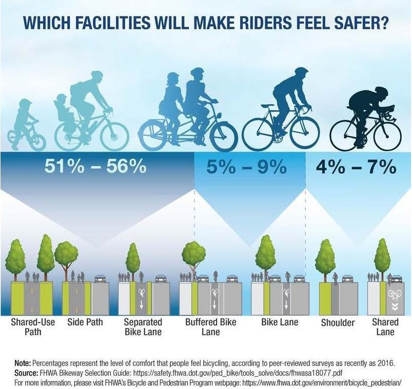
Graphic source: FHWA. For more info, visit FHWA's Bicycle & Pedestrian Program webpage: https://www.fhwa.dot.gov/environment/bicycle_pedestrian/
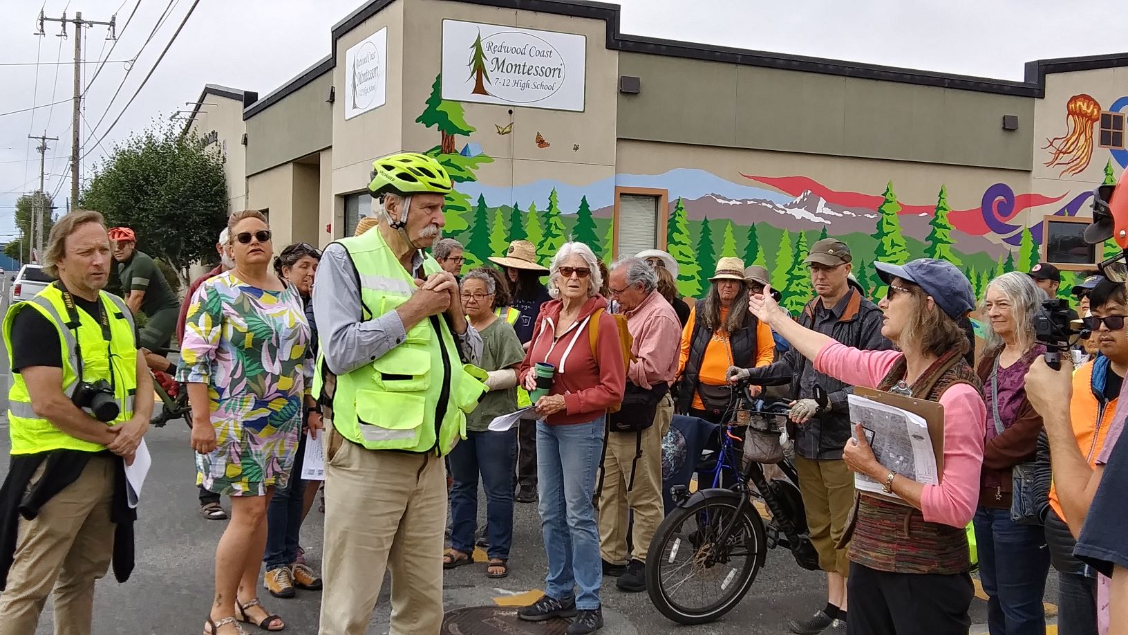
Walkability and Complete Streets innovator and expert Dan Burden visited our neighborhoods to perform walk audits in Arcata, Eureka, Manila, and McKinleyville (July 2023). And again in 2025 Dan visited, as part of HCAOG's "Multimodal & Vibrant Neighborhoods Planning Project," this time accompanied by Victor Dover, nationally recognized as an innovator in city planning, neighborhood design and street design. We did more walking audits in Arcata, Eureka, and Hoopa Nation, and more. Check it out below!
Walk Audits & Presentations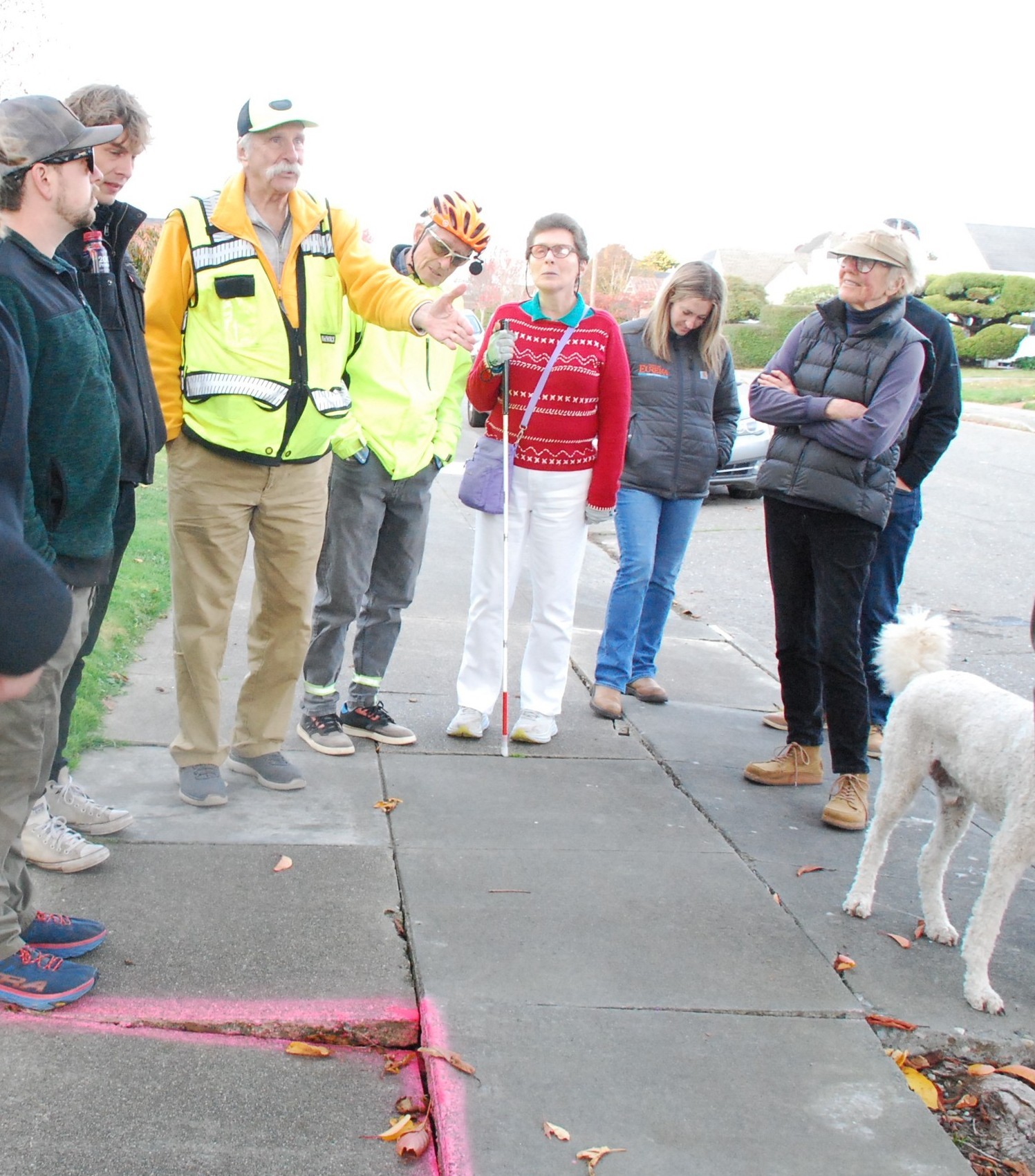
For your reference: What You Will Get from a Walking Audit
• A Primer Series - curated webinar videos
ARCATA:
2023 City of Arcata video - Arcata Walk Audit (50 minutes) - July 22, 2023; Arcata Photos (29 MB)
2025 ☼ ARCATA WALKING/BIKING AUDIT. Held Dec. 1, 2025. Audit of Guintoli Lane, Valley West & Valley East Blvd. | Arcata Event Flyer | Technical Memo
BLUE LAKE:
2023 Blue Lake - Walk audit presentation video (72 minutes) - July 25, 2023; Blue Lake - slide deck (100 MB)
EUREKA:
2023 City of Eureka video- Old Town Eureka Walk Audit (66 minutes) - July 23, 2023
2025 ☼ EUREKA WALKING/BIKING AUDIT. Held Dec. 1, 2025. Audit of Harris St., F & G Streets, Henderson St. | Eureka Event Flyer | Technical Memo
HOOPA:
2025 ☼ HOOPA WALKING/BIKING AUDIT. Held Dec. 2, 2025. Audit of Tish Tang Road, Airport Road, to K’ima:w Medical Center. | Hoopa Event Flyer | Technical Memo
MCKINLEYVILLE: [under construction]
2023 McKinleyville Municipal Advisory Committee special meeting - slide deck (110 MB) - July 25, 2023
2025 ☼ McKinleyville Community Meeting, Dec. 2, 2025. | Event Flyer | Slide deck (577 MB pdf - pending. File too large to preview.)
REGIONAL & OTHER:
2025:
- ☼ Regional Community Workshop Held Dec. 3, 2025, Wharfinger Building, Eureka | Event Flyer (English & Spanish) | Workshop video recording of entire presentation (1:58 mins, YouTube channel). (To request Dan & Victor's slidedeck, contact HCAOG.)
- ☼ Humboldt Region Walkability Toolkit & Recommendations (pdf, 16 MB)
- ☼ Active Transportation Tools and Resources (pdf, 304 KB) List of website resources for active transportation and traffic safety; walking and bicycling audits; and pop-up demonstrations and quick-build projects.
2023:
- Technical Meeting w/ Local Agencies, held July 24, 2023. Presentation (City of Arcata video) (79 minutes) | Technical Meeting slide deck (151 MB)
- Dan Burden presentation, Walkability: Building Streets and Towns for People and Place First. Held July 24, 2023, Wharfinger Building. Video of Humboldt presentation 7/24/23 (1hr 43m, Access Humboldt archive); Humboldt presentation - slide deck (146 MB)
Local Coverage
2023:
- Lost Coast Outpost Article "How Do We Make Our Communities More Walkable? Dan Burden Knows, and He’s Coming to Humboldt to Help Us Out"
- Times Standard Article "Humboldt County Walkability Audit Presentation Well-attended"
- "The Econews Report: What’s a Walkable Community?" (30-min podcast; aired July 29, 2023) (transcript available here (Lost Coast Outpost))
Articles by Dan Burden
"Making the Healthy Choice the Easy Choice" (126 KB)
"Why Walkability Matters" (157 KB)
List of website resources for active transportation and traffic safety; walking and bicycling audits; and pop-up demonstrations and quick-build projects. (Download the list in pdf format here: Active Transportation Tools and Resources (304 KB, Blue Zones 2025 for HCAOG))
● A Systematic Safety Study of Pedestrians in Tribal Areas [from US DOT Repository & Open Science Access Portal; creators: Brent Crowther, Eric J. Sweat]
● Small Town and Rural Multimodal Networks (from Federal Highway Administration's Bicycle and Pedestrian Program)
● Local and Rural Road Safety Program (from US DOT Federal Highway Administration) — For local practitioners: Local Road Safety Do It Yourself (DIY) tool, Safety Toolkit, Maintenance for Rural Road Safety, Local Rural Road Owners Manuals, etc.
● Narrow Lanes Save Lives: A Way to Make to Make Our Communities Safer and Healthier
o Extensive study showing that narrower lanes can reduce crashes, injuries and fatalities. Includes policy recommendations for reducing lane widths.
● Improving Intersections for Pedestrians and Bicyclists (USDOT Federal Highway Administration)
Supplements FHWA’s series of intersection informational guides; makes direct connections to other FHWA bikeway and pedestrian facility selection guides. Note the 2022 resource informing the state of the practice on intersection planning and design to help eliminate fatalities and serious injuries while also making roads better places for walking and bicycling. Link to content source (pdf): https://highways.dot.gov/sites/fhwa.dot.gov/files/2022-06/fhwasa22017.pdf
Speed Limits:
● City Limits: Setting Safe Speed Limits on Urban Streets (from Nat'l Assoc'n of City Transportation Officials (NACTO)) See also: City Limits: Quick Guide on Conducting a Safe Speed Study and Using the Risk Matrix.
● California AB 1014 (Approved by Governor Newsome on Oct. 3, 2025) — Modifies the traditional 85th percentile rule by allowing Caltrans and local authorities to set speed limits lower than prevailing traffic speeds.
Edge Lane Roads:
● www.edgelaneroads.com
● Safety Considerations for All Road Users on Edge Lane Roads (from Mineta Institute, San José State University)
● Exploring Possible Applications of Edge Lane Roads in the Richmond Region Intro and Guidance
● Advisory Bike Lanes (from NACTO. Adapted from Urban Bikeway Design Guide, 3rd ed.)
Street Lighting:
● FHWA Roadway Lighting Resources. Highlighting Minnesota Department of Transportation's Street Lighting at Rural Intersections.
Active Transportation Programs:
● Active Transportation Resource Center (ATRC) (from California's Active Transportation Program) Webinars, trainings, events, resource library, and projects and programs to support active transportation initiatives.
● Active Transportation Programs Design Guide (from Washington State DOT) Helpful reference published in 2024 with engineering standards and preferred treatments to create safer, connected and low-traffic stress environments.
Documents
This Humboldt Regional Bicycle Plan is foremost a regional plan, intended primarily to facilitate projects and programs that will help build a bikeway system that makes bicycling throughout Humboldt County a safe, convenient, and practical means of transportation for all residents and visitors. Priority infrastructure projects will link adjoining jurisdictions’ bicycle routes and thereby build a regional bicycle network. The Bike Plan’s recommended projects and programs have the potential to considerably increase the number of bicycle trips in Humboldt County.
HCAOG has prepared two documents to facilitate quality bicycle parking in Humboldt: "Countywide Bicycle Parking Guidelines: Recommended Policies & Requirements" and "Bike Parking Sourcebook: Sample Policies, Municipal Codes, & Programs."
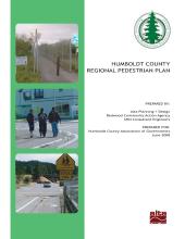
The Humboldt County Regional Pedestrian Plan is a guide for developing future pedestrian infrastructure in the county. The Plan aims to make walking an integral transportation mode by proposing improvements to the pedestrian network. The study area is all of Humboldt County, although it focuses on places with the highest density of destinations within walking distance. (The Plan was prepared by Alta Planning + Design, Redwood Community Action Agency, and SHN Consultant Engineers.)
Bike Rentals
The City of Arcata, Cal Poly Humboldt, and Tandem Mobility have teamed up to bring bike share back to Humboldt County. With 40 bikes at 8 stations and affordable pricing, exploring Arcata and the campus has never been easier. Visit www.tandem-mobility.com/humboldt for more information.
Bike rentals, and guided biking and hiking tours. Visit www.wildtrailtours.com.